Moon Handbooks Michigan
©Tina Lassen. All rights reserved. Any use of this text, in whole or part, without written permission of the publisher and author is prohibited by law.
THE EASTERN UPPER PENINSULA AND THE STRAITS OF MACKINAC
Perhaps more than anywhere else in the state, the eastern Upper Peninsula offers up a landscape of remarkable contrasts. The swath of land stretching from Grand Marais east to Whitefish Point remains some of the most inaccessible and lightly traveled in all of the Midwest, a long-ago pine forest reduced to sandy or marshy cutover land by turn-of-the-century loggers. Travel can be slow-going here, whether on foot or in a vehicle. Much of the eastern end of the peninsula will remain undeveloped, too, with thousands of acres from Lake Superior to Lake Michigan protected as a unit of the Hiawatha National Forest, and hundreds more managed by the Lake Superior State Forest.
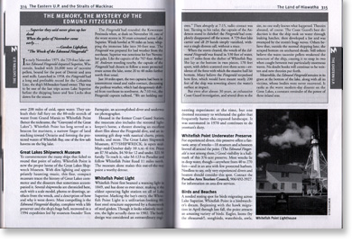
Adding to the allure of this remote terrain are the rivers twisting through the region--clear, spring-fed waters like the Two-Hearted and the Tahquamenon, prized by anglers and paddlers who know that the extra effort required to reach their banks will be well rewarded. And of course, there's Lake Superior dominating the northern horizon, a stretch of shoreline known as the "Graveyard of the Great Lakes." More than 300 ships have foundered here, including the 729-foot Edmund Fitzgerald, which disappeared off radar in a November 1975 storm, just 17 miles northwest of Whitefish Point.
Yet by contrast, the eastern U.P. also holds such popular attractions as Tahquamenon Falls, one of the largest waterfalls east of the Mississippi (and with impressive crowds to match on summer weekends); Manistique Lakes, abuzz with powerboats; the busy shipping traffic of the Soo Locks; and the granddaddy of all Michigan tourism, magical Mackinac Island. In such an eclectic corner of the state, it seems only fitting that the Victorian fairy tale of Mackinac Island should sit in the shadow of a modern engineering marvel, the Mackinac Bridge. After all, this is where the two disparate halves of Michigan are forced to meet, if only by the tenuous tether of a manmade bridge.
MACKINAC ISLAND
No place name in Michigan conjures up as much history, as much attention, and as much affection as the tiny parcel known as Mackinac Island. Over the centuries, the 2,200-acre island has been a sacred ground for the native Indians who summered here, an important base for French fur trappers, a fort for British soldiers, and a gilded summer retreat for the wealthiest of Victorian-era industrialists.
It is the Victorian era that Mackinac chose to preserve, from the exquisite 1887 Grand Hotel, with its 660-foot-long porch stretching across the hillside, to the clopping of the horse-drawn carriages down the vehicle-free streets. Yes, it can seem touristy at first blush. Yes, it can be crowded. But Mackinac Island can also be irrepressibly charming, all buffed up and neatly packaged, the state's heirloom jewel.
Some of the criticism lobbed at Mackinac is based on misconception, anyway. For starters, Mackinac is more than the tangle of fudge shops and cheap souvenirs that greet you at the ferry dock. A full 82 percent of the island is state park, comprising a restored 18th-century fort and largely undeveloped woodlands, crisscrossed with hiking and biking trails, and sprinkled with rare wildflowers and sculpted limestone outcroppings.
Secondly, Mackinac Island has far more lodging choices than the famous--and spendy--Grand Hotel. Many are moderately priced. Plan to spend at least one night, so you have a little time to wander around and get past the cliche. Mackinac doesn't lend itself well to a cursory glance. (Isn't that the joy of islands in the first place?) Like those wealthy resorters knew, Mackinac is the place to relax and retreat from the pulls of the real world.
Downtown
Everyone wants to wander among the four blocks of shops and restaurants on Main Street. The ferry docks themselves are particularly interesting. At the Arnold Line dock, you can sneak a peek at the day-to-day grunt work of Mackinac, like workers unloading carton after carton of vegetables from the ferry and reloading them by hand onto drays (wagons) for horse-drawn delivery to area restaurants. Even the UPS man does his route on bicycle, pulling a cart loaded with packages.
Once you've done the Main Street stroll and nibbled your requisite hunk of fudge (there's a reason tourists are known as "fudgies"), make the most of your visit by getting off the main drag. You can get a good taste of what the island has to offer on a carriage tour with Mackinac Island Carriage Tours, tel. (906) 847-3307, located across from the Arnold Line ferry dock next to the chamber of commerce. The pleasant narrated tour takes about two hours, rambling along at a relaxing pace past the Grand Hotel, Arch Rock, Skull Cave, Fort Mackinac and most of the island's other key sights. This locally owned business is the world's largest horse and buggy livery, with more than 300 horses, mostly crosses of beefy Percherons, Belgians, and Clydesdales. Rates are $15 adults, $7.50 children 4-11.
One block inland from Main, some of Mackinac's original residences line up on Market Street. Much quieter than frenetic Main, Market has several interesting stops for visitors. The headquarters of the American Fur Co., John Jacob Astor's empire, is now the Robert Stuart House Museum. The 1817 building retains much of its original decor, including fur company ledgers, fur weighing scales, and other artifacts. The museum is operated by the City of Mackinac Island and is open daily June-September.
A block west, knowledgeable interpreters demonstrate spinning at the Biddle House and smithing at the Benjamin Blacksmith Shop. These and other historic buildings are part of the state park, and are included with the admission ticket to Fort Mackinac. They have shorter hours than the fort, though, open from 11 a.m. to 4 or 5 p.m. For current information, stop by the park visitors center across from Marquette Park on Huron Street, or contact Mackinac State Historic Parks, 213/436-4100, www.mackinacparks.com.
From Marquette Park, follow Fort Street up the hill to the Governor's Residence at the corner of Fort and East Bluff Road. The state purchased the "cottage" in the 1940s. It is the official summer residence of the governor, though the amount of time actually spent here varies from governor to governor. The house is open for tours on Wednesday mornings.
Natural Mackinac
Often overshadowed by the many more advertised visitor attractions, Mackinac Island's natural history has attracted scientific observation for nearly 200 years. In the early 19th century, botanists discovered several species completely new to science, including the dwarf lake iris, still found only in the Straits of Mackinac region.
Early scientists also marveled at the island's distinctive geology, mostly brecciated limestone that has been sculpted by eons of wind and waves. The result is some dramatic rock formations, like the giant inland slab of limestone called Sugar Loaf Rock, the lakeside caves of Devil's Kitchen, and impressive Arch Rock, which rises nearly 150 feet above the eastern shore and spans some 50 feet.
In recognition of the park's distinctive "natural curiosities" and growing tourism, the U.S. government created Mackinac National Park in 1875--following Yellowstone as the nation's second national park. Twenty years later, it was returned to Michigan and became Mackinac Island State Park, Michigan's first state park.
Walk, run, or bike, but make sure you get out of downtown to really see Mackinac Island. You'll be surprised how quickly you can leave any crowds behind as you set out on the paved eight-mile path that circles the island. The trail never wanders far from the pleasant shoreline and passes many of the island's natural features, which are well marked. Traveling clockwise, the first you'll reach is Devil's Kitchen; heading in the opposite direction, you'll arrive first at Arch Rock, the most dramatic of all Mackinac limestone oddities.
About halfway around, on the island's northwestern side lies British Landing, where British soldiers sneaked onto the island in 1812. They hiked across Mackinac's interior, totally surprising the American garrison stationed at the fort (and apparently looking the other way), and recaptured the island. Today, the landing is a good spot for a picnic or short break (water and restrooms available).There's a small nature center here, staffed in summer months by a helpful naturalist. Hike the short nature trail, which has several interpretive signs as it weaves up a bluff.
British Landing is also a good spot from which to head inland and explore the island's interior. British Landing Road bisects the island and links up with Garrison Road near Skull Cave and leading to the fort. It's a hilly, three-mile trip from shore to shore. British Landing Road is considered a "major road" by Mackinac standards, meaning you'll share it with carriages. On bike or foot, you'll have endless other options?at last count, Mackinac had some 140 miles of trails and footpaths.
THE WESTERN UPPER PENINSULA
The Keweenaw Peninsula may have its roots in veins of copper, but much of the rest of the western Upper Peninsula traces its heritage to iron. You can read it in the town names--Iron Mountain, Iron River, Ironwood, National Mine, Mineral Hills--and see it on the faces of the residents, an ethnically diverse mix descended from the melting pot of immigrant mine workers.
The U.P.'s iron industry stretched from the western border east some 150 miles to the Lake Superior port of Marquette and the Lake Michigan port of Escanaba. It comprised three major ranges: the Gogebic Range, with operations centered around Ironwood; the Menominee Range, based largely around the Iron River and Iron Mountain areas; and the Marquette Range, encompassing Marquette and the Ishpeming/Negaunee area.
Federal surveyors first discovered iron ore in 1844, near present-day Iron River. As workers systematically surveyed this strange landmass recently acquired by Michigan, their compasses swung wildly near Negaunee, where iron ore was so plentiful it was visible even on the surface, intertwined in the roots of a fallen tree. The tree is the official symbol of the city of Negaunee, which itself became completely intertwined with the rise and fall of the iron industry.
Aside from a handful of small mining operations, the unfathomable wealth of the Upper Peninsula's iron remained largely untapped for several decades, until the ever-expanding web of railroad lines reached the area. In the 1870s, the arrival of the railroad prompted the first major mines in the Menominee Range. A few years later, the Gogebic Range opened. Many of the early mines were open-pit affairs, but soon the need for iron ore drove miners deeper and deeper underground. Today communities like Ishpeming sit atop a Swiss-cheese patch of earth riddled with mine shafts and adits; occasionally, tracts of land sink, leaving behind tilted and abandoned houses. Near Iron Mountain, the entire town of Norway was moved--twice--when the streets kept caving in.
World War II and its insatiable demand for iron drove area mines to peak production, eventually depleting some of them. By the 1960s and 1970s, the western U.P. iron ranges grew quiet after shipping out nearly two billion tons of ore. All underground iron mines in the U.P. closed by 1978, hurt by foreign steelmakers and the use of more and more plastics in manufacturing. Only a few open-pit mines remain in operation; you can see one in Republic, where a small viewing platform (free) overlooks a gargantuan crater in the earth. Republic is located just off M-95 about six miles south of US-41 in Marquette County.
Today outdoor pursuits dominate the western U.P., a region liberally dotted with lakes, stitched with rivers, and sculpted with ancient mountains jutting skyward from Lake Superior. While folks from other parts of the country may scoff at the Midwest's idea of mountains, the altitudes in this part of the U.P. rise to downright unmidwesternly heights: Mt. Arvon, deep in the Huron Mountains due east of L'Anse, measures 1,979 feet.
The western U.P.'s surprising terrain matches its surprising variety. It is a land of popular downhill ski resorts and private old-world enclaves of the super-wealthy. A place to explore remote paddling lakes and excellent museums. Home to derelict towns with strip joints, and the smart and pretty city of Marquette, the U.P.'s largest. Did we say city? Travel a half hour west, and you can hike through remote terrain that's home to the state's largest moose herd. Wolves roam undisturbed just a few counties south. The iron ore may lie deep underground, but the western Upper Peninsula offers plenty of magnetic attractions up on the surface, too.
SYLVANIA WILDERNESS AND RECREATION AREA
Sylvania protects its assets well: 36 crystalline glacial lakes hidden among thick stands of massive, old-growth trees. For anglers who dream of landing (and then releasing) that once-in-a-lifetime smallmouth bass, for paddlers who yearn to glide across deep, quiet waters and along untrammeled shoreline, for hikers who wish to travel under a towering canopy of trees and hear nothing more than the haunting whistle of a loon, Sylvania can be a truly magical place.
One of three wilderness areas within the national forest, Sylvania stretches across 18,000 acres near Watersmeet, an area roughly bordered by US-2 to the north, US-45 to the east, and the Wisconsin border to the south. The adjacent Sylvania Recreation Area acts as a buffer, an additional 3,000 acres of lakes and woodlands with a few developed services like a drive-in campground, nice beach, flush toilets, and running water.
Once viewed as just another tract of good timber, Sylvania's fate turned in the late 1890s, when a lumberman who purchased 80 acres near the south end of Clark Lake decided it was too lovely to cut, and instead kept it as his personal fishing retreat. He invited his wealthy buddies?some of them executives of U.S. Steel?who also were captivated by the land. Together, they purchased several thousand additional acres and formed the private Sylvania Club.
Like other upscale U.P. "great camps," the Sylvania Club soon had grand log lodges along its shores, guards to keep trespassing anglers away from its bountiful lakes, and caretakers to squelch forest fires as they cropped up. Ownership changed a few times over the decades, eventually ending up in the hands of Lawrence Fisher of Fisher Auto Body. When he died, his heirs sold the property to the federal government for $5.7 million. It was operated as a recreation area from the late ?60s to 1987, when the bulk of it was converted to wilderness status.
We can partly thank Old Money for the condition of the land today. With the public previously barred from fishing here, Sylvania's lakes now provide some epic fishing, especially for bass. Its waters remain pristine, thanks to the lack of development and powerboat access, as well as the area's topography: Sylvania lies on the divide between Lake Superior and the Mississippi, so it doesn't suffer from runoff of nearby lands. And whatever your thoughts on fire management, Sylvania's decades of fire protection means that visitors today can marvel at a virgin forest of white pine and hardwoods--hemlocks, maples, and basswood trees more than 200 years old.
Begin a trip to Sylvania with a call or visit to the Watersmeet Visitors Center, P.O. Box 276, Watersmeet, MI 49969, tel. (906) 358-4724, at the intersection of US-2 and US-45. The staff can help you with maps, regulations, campsite reservations, and other information. Sylvania's rules can be quite unique--especially fishing regulations--so take time to ask questions and read through the materials rangers provide. To reach Sylvania itself, follow US-2 west about four miles from the visitors center and turn south on Thousand Island Lake Road. Travel about 4 miles, following signs to reach the entrance building. All visitors are required to register upon arrival.
The entrance sits in the recreation area, near the drive-in campground on Clark Lake. If you intend to travel into the wilderness area, plan on treating your own water; you'll find water pumps only in the recreation area. Cookstoves are highly encouraged, too, to lessen the number of feet tramping through the forest in search of dead wood. During summer months, make sure you also have ample bug dope or, better yet, a head net to combat mosquitoes and black flies.
Like the Boundary Waters Canoe Area in Minnesota, paddling is the best way to explore the Sylvania Wilderness. Most lakes are linked by water or by relatively easy portages (though there are a couple grunt portages of two miles or more). Many campsites are accessible only by water. Motors and other "mechanized equipment" are forbidden. (That even includes sailboats.) The one exception is Crooked Lake, which allows electric motors of 4hp or less.
From the entrance road, you can park your vehicle and put in at Clark Lake or Crooked Lake. According to a ranger, Clark (the largest lake), Crooked, and Loon are the three busiest lakes. Some of the smaller lakes--like Mountain and High, both accessible from Crooked--see less traffic and are just a short portage away. One ranger recommends bringing snorkel gear--the crystal-clear waters provide great visibility for viewing monster fish. Rent canoes and kayaks from Sylvania Outfitters, 23423 US-2 in Watersmeet, 906/358-4766, www.sylvaniaoutfitters.com. You can outfit your entire trip--boat, food, fishing gear, maps--at this helpful spot, and even arrange to have the stuff delivered and picked up from water's edge.
For hikers, Sylvania maintains 15 miles of trails, including a seven-mile trail (marked with blue blazes) around Clark Lake. It provides access to campsites and trails to other lakes. Most of Sylvania's trails are old roads left over from its fishing-camp days; though not always well-marked, they are quite easy to follow. These same roads become a great cross-country ski network in winter months. The national forest grooms 15 miles of trails within Sylvania.
BIG BAY AREA
Many people approach the Huron Mountains from the east, where CR-550 climbs 30 miles out of Marquette to the tiny town of Big Bay, population 260. Sited above Lake Independence and within minutes of Lake Superior, Big Bay is a scrappy little place, where residents take pride in their simple life on the fringes of wilderness. The town has swung from prosperity to near-ghost-town status more than once, first as a bustling logging outpost, then one of Henry Ford's company towns, home to busy sawmills. More recently, residents joke about how the local bank, well aware of the town's volatile economy, was loathe to loan money to Big Bay businesses; while the town's 20 businesses are thriving, the bank closed down. Folks now frequent Big Bay for its Huron Mountains access, Lake Superior harbor, Lake Independence fishing, and unique lodgings (see Practicalities, below).
From Big Bay, your best bets for venturing into the backcountry are CR-510, which branches off CR-550 on the southeast edge of town, and the Triple A Truck Trail, which branches off of CR-510. Both are usually well-maintained dirt/gravel roads, though be aware that wet or snowy weather can quickly render them impassable. Dozens of old logging roads and single track branch off of these main routes. To find your way around, you'll want a topo map or a very good local map (sometimes called the "waterfall map") available free from the Marquette Country Convention and Visitors Bureau.
The waterfall map will indeed point you toward many of the region's wealth of waterfalls. Some of the finest and/or most accessible include Big and Little Garlic Falls, Hills Falls, and Big Pup Falls. The latter two are part of the Yellow Dog River, a beautiful river that splashes and tumbles over cliffs and through canyons from the Yellow Dog Plains north to Lake Independence. Pack a fly rod if you enjoy casting for trout--fishing can be great here.
The Commercial Forest Reserve Act gives property owners a tax break in exchange for allowing others access onto their property, so trespassing isn't really an issue as you explore the Huron Mountains. As a result, you have near limitless possibilities for hiking and mountain biking on old logging roads and various foot trails. Two spots worth exploring are Gobbler's Knob, a rock outcrop off CR-510 that overlooks Lake Independence and Lake Superior; and the Eliott Donelly Wilderness Area off CR550, where a four-mile trail winds along the Little Garlic River and past Little Garlic Falls.